Tour of the Alps 2004
by Jobst Brandt

|
|
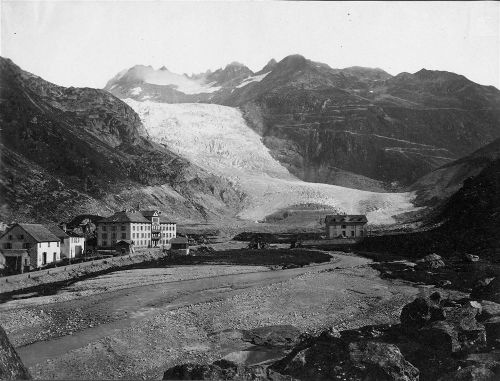
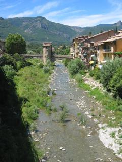
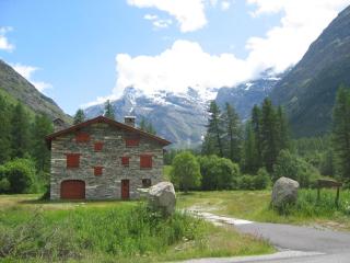
| Gletsch 2004... | ...and 100 years ago. |
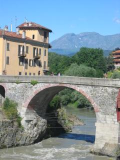
Sunday, 04 July, Bob Walmsley and I flew with American Airlines from San Francisco to Zurich where we arrived Monday morning and caught a train from the ZRH airport to Schwyz where Turi Dierauer picked us up for the short ride to his house in Ibach, the town where Victor Inox, aka Swiss Army Knife, is at home. We used bicycle bags from Nashbar for the bicycle, wheels strapped to the side of the frame, cranks and derailleur removed and forks and handlebar facing back. We assembled our bicycles and took a ride around Schwyz, visiting Victor Inox, the old downtown and the school I once attended there. Then we rode around the Lauerzer See in the shadow of the Rigi. This kept us awake for the usual raclette cheese dinner and good night's rest. Edith and Turi Dierauer have been my gracious hosts for many bike tours as did the senior Dierauers before them.
| 
|
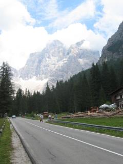
| The old school | Schwyz, Mythen |
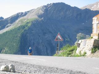
1. Tuesday, 06 July (Ibach - Wilderswil); 140km, 3008m):
During the night we heard the roar of heavy rain that gradually let up by daybreak although it was still wet as we headed off in a warm drizzle to Brunnen on the Vierwaldstettersee (aka Lake of Lucerne) to take the Axenstraße along the east shore toward the Klausen, Susten, and Gotthard passes.
www.schweizerseiten.ch/info/axenstrasse.htm
The Axenstraße is noted for its rugged cliffs dropping steeply to the lake. While the railway stayed mostly in tunnels, our road wound its way through short tunnels on our way to Flüelen at the end of the lake. It was along these cliffs that William Tell was said to have duped the Austrians, who had taken him captive and were returning by boat to their headquarters when a fierce storm arose. Tell convinced them to take off his shackles so he could guide them to a safe landing along these cliffs. Instead he jumped ship when they got close to the wall and vanished up trails that only the locals knew. The Austrians went under, according to the chronicles of Friedrich von Schiller, who created William Tell as a composite figure of the Swiss nationalists.
www.picswiss.ch/Historie/g-hip3-7.html
www.bartleby.com/26/6/
www.kulturschweiz2004.ch/geschichte/200jahre.asp
We took pictures of the Tell monument in Altdorf where Tell stands proudly, bigger than life, in bronze, son at his side, with crossbow (Swiss trade mark) over his shoulder in front of a mural of the Alps of canton Uri for a backdrop. It was raining.
www.tell.ch/schweiz/telldenkmal.htm
www.ur.ch/
The rain let up as we rolled out on up the Reuss valley where above Erstfeld (472m) the huge SBB 57km Gotthard tunneling project lies with its huge piles of granite extracted from the mountain. We were assured that all this material will be removed and the ground returned to agriculture.
We started climbing at the SBB hydropower plant in Amsteg, where the Reuss valley becomes a narrow and steep alpine ravine. The climb starts abruptly on a stone-arch bridge over the Reuss. The highway wends its way along the granite walls while the double track SBB, in order to not exceed a 2.7% grade, uses helical tunnels to gain altitude on its way to the original 16km Gotthard Tunnel. We met little traffic because it stayed mainly on the four lane Autobahn that is mostly out of sight in tunnels and avalanche sheds.
We reached the road junction to the Susten pass in Wassen (916m), that lies in the middle of three passes of the railroad between tunnel loops. We weren't ready for a restaurant lunch and because it was after 12:00 the grocery store was closed, so we made do with some food from the saddlebag in the village square that sits on a rock pedestal in the Reuss Valley.
| 
|
| Meienschlucht Wassen | Susten Meiental |
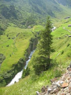
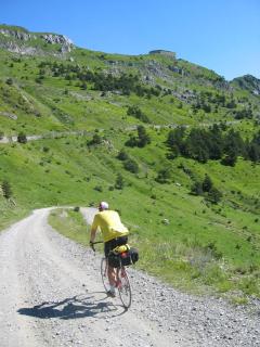
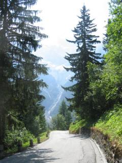
The Susten road heads into the south wall of the canyon, into the Meiental that lies hidden behind a granite wall through which the Meienreuss River flows in a narrow slot. The climb starts in the town square into a curved tunnel from which a stone arch bridge over the cascading river connects to another tunnel. How the ancients got through here is unclear, but farther up, the old Susten pack animal route is still visible as it zigzags steeply up the headwall of the canyon. The road has a fairly continuous 8% grade with a couple of steeper parts at 10%. Although the Susten could be called the glacier highway of the Swiss alps for its spectacular ice fields, not much of that was visible in the clouds that opened only a bit now and then.
www.paloaltobicycles.com/alps_photos/s42.html
|
| Bob & Wetterhorn |
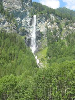
We had "good climbing air" as we gained altitude although there wasn't a trace of wind. As we reached the tunnel at the summit of the Susten Pass (2224m) we were practically in the clouds so not much of the great Steingletscher was visible, not to mention the Sustenhorn high above. I could fill in the blanks, so to speak, but I hoped for better for Bob who had never seen this striking landscape except in pictures. The descent was warm enough that I didn't need my jacket that I had packed away in Wassen. Descending to Inertkirchen (625m) in the Haslital, where crossed Aar river to climb the short Kirchet pass (709m) with its four hairpin turns to get past the narrows, the Aareschlucht, an impressive slot in the cliffs through which the Aar river flows. A scenic path cut in the wall enables visitors to hike through the gap while the passes railway takes a tunnel.
We turned off to Rosenlaui just beyond the pass, across from the Lammi restaurant on a steep, paved, and little more than one-lane wide road that climbs through a forest to the canyon of the roaring Reichenbach where Sherlock Holmes and Dr. Moriarty met their deaths over the falls in 1891.
www.sherlock-holmes.org/atlas/europe/reichenbach_falls.html
We passed the new Hotel Zwirgi in Schattenhalb, at the junction of the road from Meiringen and stopped at the water works for a big drink of ice cold water where the phrase "Das Wasser ist das Beste" graces the wall above the fountain. The climb to Rosenlaui is still no trifle as it rapidly gains altitude past hotel Kaltenbach, finally leveling off in the Rosenlaui Valley.
www.paloaltobicycles.com/alps_photos/s38.html
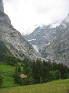
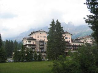
The road was still wet in places as we reached the valley where we got a splendid view of the Rosenlaui Glacier. We dropped in at Hotel Rosenlaui to say hello to Andreas and Christina Kehrli, the owners of the hotel. I had a chance to thank their three children for giving me such excellent service at dinner last year. We were much too early to consider staying for the night so we settled on a desert before continuing up the road.
www.alles-fahrbar.de/alte_homepage/Mountain2002/17bild.htm
| 
|
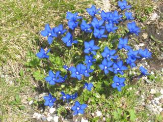
| Lower Grindelwald glacier | Enzian flower |
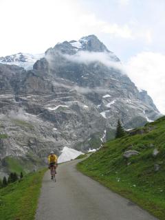
The public road ends at Schwarzwaldalp where a steep 100m-long connector got us to the restricted-access, smoothly paved Grindelwald Bus road. This road is only as wide as the bus that does not slow down for bicyclists. Something worth knowing. The road climbs through meadows with grazing cows amidst wildflowers as it heads to Grosse Scheidegg (1961m) beneath the walls of the glacier covered Wetterhorn (3701m).
www.paloaltobicycles.com/alps_photos/s37.html
www.paloaltobicycles.com/alps_photos/s84.html
Cloudy weather seemed to have kept tourists indoors because we met no hikers and bikers over the pass. Under cloudy skies, we saw parts of the dark north face of the Eiger in front of the pure white Jungfrau, and Grindelwald (1034m) below, seemingly in miniature, surrounded by steep green meadows.
We were back on public roads just before Grindelwald. We began descending after the train station, where the Berneroberlandbahn (BOB) meter gauge (adhesion and Riggenbach cogwheel) railway makes connections with the Wengernalpbahn (WAB) 800mm gauge (Riggenbach cogwheel) train that crosses the valley to the Kleine Scheidegg (2016m). At Kleine Scheidegg the famed Jungfraubahn meter gauge (Strub cogwheel) tunnels inside the Eiger (3970m) to the station in an ice cave on the Jungfraujoch saddle (3454m) between Mönch (4099m) and Jungfrau (4158m).
Descending along the cascading Schwarze Lütschine we joined the Weisse Lütschine from Lauterbrunnen at Zweilütschinen. Crossing bridges we were engulfed in chilled air from the icy river over which an icy fog from the high humidity hung. It gave us the feeling of entering a deep freezer whenever we got close. We reached the bottom of the valley at Wilderswil (584m). From here the Schynige Platte Bahn (SPB), 800mm gauge train (Riggenbach-Pauli cogwheel) climbs to the Schynige Platte (2061m) to give a marvelous panorama of the Jungfrau group... in fair weather. I hadn't stayed in Wilderswil in many years and was disappointed to not find the simple comfortable hotel from those days. We got a good hotel with excellent food but a bit high in the four star class.
2. Wednesday, 07 July (Wilderswil - Biasca; 162km, 3008m):
With a partly sunny morning we took a picture of the Mönch (4099m) looking across the large meadow in the middle of Interlaken (563m) for a postcard view up the Lauterbrunnental to the Jungfrau. Crossing the Aar River we rode along the north shore of the Brienzersee to Brienz, a small town in a narrows between the cliffs and the deep blue lake. Here the steam powered Brienzer Rothornbahn (BRB), 800mm (Abt cogwheel) railway was getting ready to climb through tunnels in rugged cliffs to the top of the Brienzer Rothorn (2353m), in my estimation the premiere mountain railway of the Alps. The pungent smell of coal smoke from the locomotive wafted across the road as we passed.
digilander.iol.it/zh/cograilways/brienzer.html
| 
| 
|
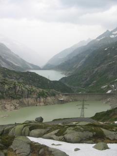
| Grimsel KWO man | Grimsel KWO lakes | Grimsel seen from Furka |
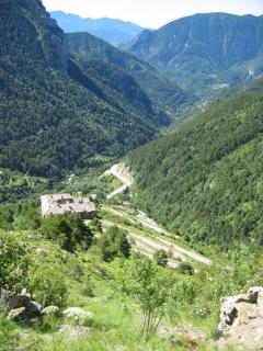
We photographed Sherlock Holmes, in life-sized bronze, with pipe, cape, and deerstalker cap sitting in the middle of Meiringen, the home of meringue. After Willigen, a short climb up the Kirchet (709m) got us to Inertkirchen and the approach to the Grimsel Pass up the Haslital. The Grimsel road has three reprieves, one in Guttannen (1057m), with a good grocery store, and another at Handegg (1402m), with good accommodations in case of foul weather and finally above the upper dam as the road follows the lakeshore. The road climbs between granite walls to lower and upper concrete dams that are reached in winter by giant aerial trams.
www.paloaltobicycles.com/alps_photos/s90.html
The road enters a one-kilometer tunnel above Handegg where bicyclists must (and prefer to) take the old cobblestone road, notched into the granite wall high above the Aar. The detour is less steep than the one kilometer tunnel and offers great scenery. As we rode around the upper Grimsel lakes, the Finsteraarhorn (4275m), tallest peak in the Bernese Alps, lay at the end of the valley to the west, "finster" (dark) because like the Eiger, it is too steep to retain snow. It stands over the Unteraar and Oberaar Glaciers, the sources of the Aar River. We rode past some snow drifts and a good cover of melting ice on the summit lake on the Grimsel Pass (2165m).
|
| Rhonegetscher and Furkapass |
From the summit we had a view into Gletsch (1759m) with its hotel, train station, and the Furka road junction nearly straight below beyond a series of hairpin turns of the Grimsel road. Above to the east, the Galenstock (3583m) and the Furka gap were the backdrop for the Rhone Glacier and the adjacent Hotel Belvedere. We stopped in Gletsch at the Dampfbahn Furka Bergstrecke (DFB Furka Steam Railway) train station and perused their collection of historic books and paid member dues before heading up the Furka Pass.
www.furka-bergstrecke.ch/ger/souvenirs/heft_75jahre_fo.htm
www.paloaltobicycles.com/alps_photos/s67.html
The climb is easy with only one steep section before the photogenic hairpin turn below the Belvedere (2272m). This curve offers a great opportunity to pose with a glacial backdrop.
www.paloaltobicycles.com/alps_photos/s10.html
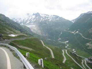
The Furka Pass (2431m), 266m higher than the Grimsel, lies in the gap at the head of this valley, swept clean except for some shrubs, by avalanches. The Furka has a great panorama that, as I experienced once on an exceptionally clear day, can include the Matterhorn to the west. Below, the DFB west portal of its summit tunnel, still deep in snow, appeared tiny in this gigantic landscape.
After crossing the broad summit, we coasted swiftly through Tiefenbach and Galenstock on the long 8% descent to Realp (1538m), the base of the grade and the east portal of the Matterhorn-Gotthard railway (formerly: Furka Oberalp) 15.4km tunnel from Oberwald. We cruised on the long straight road down the valley, next to the to the RR to Hospental (1452m), the junction of the Gotthard and Furka Passes. Having made good time, we decided to skip Hotel Rössli in Hospental this time and head over the Gotthard pass.
www.zumdoerfli.ch/roessli/hotel.htm
Although the cool overcast made for pleasant climbing, absence of sunshine to bring out the wildflowers was unfortunate. As we reached the high valley, Bob took the old cobblestone road while I stayed on concrete to the summit that was shrouded in dense fog. The wall of fog was like a demarcation line between Uri and Ticino, (the two cantons that meet there) and was so dense that we had to ride slowly for our own safety. Even the longer illuminated tunnels were 20km/h events taken with care. No pictures at the flying bridge this time and we didn't exit at the Fortezza where bicyclists are supposed to leave the new road.
www.paloaltobicycles.com/alps_photos/s04a.html
tinyurl.com/9er98
Although under solid overcast, Airolo was out of the fog so we got rolling again down the Ambri-Piotta and Rodi-Fiesso valleys into the Valle Levantina where road, autostrada, railway and Ticino river cross each other often on the descent. After Rodi (925m) we descended to Faido (711m), while trains, some with distinctive freight or international passenger cars, passed us in both directions on the adjacent double track railway. "Hey, haven't we seen that train somewhere before?" Indeed we had, because the SBB uses two corkscrew tunnels to gain/lose nearly 200m altitude above Faido.
We passed two more circular RR tunnels below Lavorga (615m) before rolling into the wide and flat valley just above Bodio (322m), the south portal of a new 57km Gotthard railway tunnel. We stopped for the day in Biasca (303m) where the distinctive dual waterfall at the train station was crossing over itself beautifully.
www.alptransit.ch/pages/e/galerie/index.php#
3. Thursday, 08 July (Biasca - Biella; 178km, 1404m):
Riding down the valley to Arbedo and Bellinzona (239m) we headed toward Giubiasco and Cadenazzo, something that isn't getting easier with time, even though most traffic goes south over the Monte Ceneri Pass (559m) to Lugano and Milano while just beyond, at Quartino, most remaining traffic went toward Locarno on the west shore of Lago Maggiore (193m). Staying on the east shore, we stopped in San Nazzaro for lunch after which we were waved through the border into Italy at Zenna.
My favorite bancomat in Luino, where in past years I had gotten Lira, wouldn't accept mu ATM card so we found another to stock up on Euros. >From Luino we rode along the lake in a series of tunnels and slide protection galleries before climbing over small ridge to Laveno where we took a ferry across the lake to Intra-Verbania on the fancier western shore with its famous resorts.
We rode up the Valle d'Ossola along the Toce River that flows from the San Giacomo Pass, and rode along the estuary to Fondo where we crossed to Gravellona. A short climb got us to Omegna (298m) from where our road stayed above steep east shore of Lago d'Orta (290m). Fancy resorts and private villas lay below along the picturesque lake with its lovely La Basilica di San Giulio monastery on the island of San Giulio off the tip of a small peninsula.
At the south end of the lake, at Gozzano (367m), we turned west in climbing a short but steep rise to Pogno (461m), where the four-spigot fountain on the piazza would have come in handy had it been warm weather, but it wasn't as we rode by. We climbed west through a canyon in a chestnut forest, typical of the southern slope of the Alps, and broke through the ridge at an unexpected tunnel (598m) from which we could coast to Borgosesia (359m). The Sesia had recovered from the summer floods of 2002 and again had ducks on crystal clear waters in which we could see large trout swimming about beneath our bridge.
Continuing toward Valle Mosso (625) we noticed signs of heavy rains and strong winds from the gravel and debris on the road and downed trees. Many of the trees had been wrenched off at the base or had twisted limbs. Farther on the road was closed by concrete barriers with warning notices of storm damage. We climbed over the barriers to continue to Mosso Santa Maria (625m) and Pistolesa at the "high bridge to nowhere" that I discovered years ago. It still seems to be a pork job and is used mainly for bungee jumping. Its great hight offers a great panorama of the Po Valley.
After crossing the bridge to Camandona, we descended to Andorna-Mico and Biella (410m). It was getting late and the sky was getting ready to dump on us, so with some directions from a taxi driver we found the Hotel Colibri just before strong winds and rain with Thor throwing lightning bolts for emphasis began. We got cleaned up and walked to a nearby restaurant while the sky opened up and the winds blew, probably tearing down more trees in the Piemonte hills. We had an excellent dinner although our pants were wet up to the knees by the splash. The booming light show continued into the night as we slumbered off.
4. Friday, 09 July (Biella - Robilante; 192km, 1004m):
Heading southwest past Zubiena (497m) and crossing a giant prehistoric glacial moraine we descended to Bollengo in the Po Valley on our way to Ivrea (254m) on the Dora Baltea River. We gave my cycling friend Brian Tomlin a call so he could meet us at the Dora Baltea bridge in the center of town from where we followed him to his home. We helped load his wife and daughter into their car for a vacation trip while Brian got changed into bikie clothes and national colors for his seniors Italian road championship.
| 
|
| Dora Baltea Ivrea | Mole Torino |
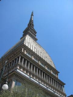
Suited up, Brian paced us on a fast ride through the hills on back roads to Torino. In order to put in a fair day at work he dropped us just north of Torino and headed back. We continued south into Torino through the old center of the city before getting on the HWY SS20, the Tenda highway. Once out of town, traffic gradually dwindled to a trickle beyond Carignano. About half way down the western rim of the great Po valley to Cuneo, we stopped at Raconigi, the former residence of the Savoy family before Italy abolished its monarchy. Storks regularly nest on large decorative urns atop this large red sandstone palace. Some were in flight brining food to the youngsters as we arrived. Their large wingspan seem so elegant to those of us who are familiar mainly with smaller fowl.
www.cicogneracconigi.it/
www.itinerari-piemonte.it/pages/naturalistici2003/cicognelipu.htm
www.ica-net.it/pascal/storia%20patria/files/racconigi.htm
Although there were mixed clouds, the Maritime alps were visible to the west on the entire route to Cuneo. When we passed the Cuneo airport I knew we were only a dozen kilometers from town but when the mountains to the south became distinct I knew we were there. We turned west along the north bank of the Stura di Demonte, where a beautifully restored bi-level stone arch bridge carries road and railway high above the river. As often, there were plenty of delicious tart Japanese plums on trees along the bridge approach.
We took a right just after crossing the bridge and stopped for a good drink from the huge fountain in front of the Cuneo (587m) train station. We rode up to Borgo San Dalmazzo where the Tenda Highway SS20 turns south to Robilante (686m) while SS21 heads west to France over the Col de Larche. We stopped at Eliano Giordanengo's amazing chainsaw store in Robilante to say hello and once more see catacombs containing hundreds of new and used chainsaws. This is noteworthy because I know no store with close to 1000 chainsaws piled from floor to ceiling, especially in such an unlikely town, far from forests. About a kilometer out of town, we stopped at Ristorante-Albergo Aquila Riale, one of my favorite stops, for a good room and dinner.
5. Saturday, 10 July (Robilante - San Martine Vesubie); 136km, 3404m):
We had another pleasantly cool day with blue skies and billowing clouds, as we rode along the Vermenagna River past huge cement plants on the way to Limone (990). Here the Tenda rail line with many tunnels and bridges enters its summit tunnel to what is now France while the road climbs a bit more steeply over large hairpin turns on the way to entrance of the 3180m-long Tenda highway tunnel (1279m), completed in its present form in 1882. A sign with a "no bicycles" icon at the tunnel portal should be expected with such along an narrow bore. A small shop with refreshments and a good selection of maps lies across the road from the not readily recognizable old Tenda Pass road.
Although paved, the narrow road appears to be used mostly by the ski area in winter, there being as good as no through traffic. In summer hikers who appreciate the many old military roads at the summit and the wonderful vistas park at the end of pavement. We climbed the pleasant grade through grassy meadows that are part of a broad ski slope, however, pavement ends about 500m from the summit, putting us back on the 19th century rocky road.
www.paloaltobicycles.com/alps_photos/f64.html
www.paloaltobicycles.com/alps_photos/f89.html
The south side of the pass, with its sixty or so tight hairpin turns lies in the steep, relatively dry ravine of the Roya River. The road was in good condition in comparison to other years, making the descent easier. Historic photographs of mule and horse teams, steam tractors, and solid-tired chain-driven trucks, that once traveled this road make today's "hardships" pale in comparison.
www.paloaltobicycles.com/alps_photos/f89.html
| 
|
| Passo Tende | Passo Tende |
Below, in the rocky gorge of the Roya, we rejoined the swift smooth curves of the Tende highway, French Rt N204, where it emerges from the tunnel (1279m). Farther down, the railway emerges from its tunnel at Vievola (990m), only to vanish into a loop tunnel followed by many bridges as it descends to Tende (816m). The road gradient is about 8% here, so it is easy to coast swiftly down into the Soarge Gorge. The road to the town of Soarge crosses the Roya and heads into a tunnel whose few windows in the opposite wall of canyon reveal its route as it climbs. Soarge is a strip of houses, glued to the cliffs, some with as much a fifty meter freefall from their windows.
www.provencebeyond.com/villphotos/breilP01.html
After the brisk ride down the Roya, past Tende and the Gorge du Soarge, we turned west up Rt D2204, just above Breil (286m), to the Col de Brauis (879m). The landscape is Mediterranean with sparse vegetation, olive trees and blooming bright yellow leafless broom (gorse) with a pleasantly sweet scent:
About 2/3 up the pass, a well fed stone watering trough that once had a "non potable" sign now has only a "non inspected" sign. The drink was as cool and refreshing as ever and I've always made that stop.
|
| Sospel |
The descent to Sospel (349m), the junction of the Brauis, Braus, and Turini passes, is pleasantly gradual. We took pictures of the old stone arch bridge in town and its collage of buildings over the Bevera River, reminiscent of the Ponte Vecchio in Florence. We stopped at the "ice cream store" and deli where the proprietor, my favorite small town philosopher, presides. Over the years, he has greeted us as though we were regulars although visits are only once a year.
www.provenceweb.fr/e/alpmarit/sospel/sospel.htm
users.skynet.be/RICHIUSO.SOSPEL/HTML/RICHIUSO.htm
After a good lunch we rode up the Bevera on Rt D70 toward the Turini Pass (1607m) of Monte Carlo Automobile Rallye fame. After climbing up the wall of the Bevera gorge, we entered a shady pine and larch forest, that make this a shady and pleasant climb. The descent offers grand views of the Gorges de Vesubie as the Turini Pass below, twists through its many buttressed curves. La Bollene-Vesubie (690m) presented the usual portrait shot before we made the final descent to the Vesubie river (520m).
hautpaysnice.free.fr/images1/mvc-629f.jpg
The road, just above the river, climbed the gradual former railway grade of the Chemin de Fer de Provence to St Martin Vesubie (930m) that lies at the end of the valley. I've often stayed in this picturesque town and always found good lodgings and good restaurants.
www.provencebeyond.com/villphotos2/stmartinP1.html
6. Sunday, 11 July (St Martin Vesubie - Condamine; 150km, 3620m):
The climb to the Colmain (Col St Martin 1500m) begins at the edge of town, looping up the canyon wall so that we soon had a panorama with St Martin so far below that it seemed unlikely that we were just down there. The road, notched into cliffs, passes through rough hewn tunnels in which Crag Martins darted past us, undaunted by passing motor traffic.
These gray-brown, swallow-like birds, tend their nests in the rocky tunnel ceilings where their young are safe from predators. Traffic and diesel exhaust seem not to bother them. Beyond a flat summit of green meadows and a ski area, we descended toward the Tinée where the terrain became dry with sparse vegetation, finally reaching the red rocky Gorges de Valabre (503m).
www.fortunecity.com/greenfield/macdonalds/296/a/a1/avionroquero.htm
www.asks86.dsl.pipex.com/europephotos/ptyrup6167.jpg
| 
|
| Rubion | Rubion |
Across the Gorges de Valabre, roads that are tiring just to look at, follow tortuous paths climbing through cliffs to mountain villages like Ilonse (1200m). We crossed the Tinée at St Sauveur (510m) on Rt D30, the Col de la Couillole (1678m), where near whose summit, we passed Rubion, a typical picturesque hill town located on steep terrain that dissuaded intruders. From the Couillole we descended to Beuil (1450m) before climbing to Croix de Valberg (1829m).
www.provencebeyond.com/villages/roubion.html
|
| Col de la Cayolle |
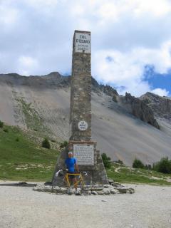
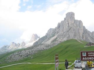
We took the "back" road, Rt D29, down to Guillaumes (1200m) where we found such an inviting sidewalk restaurant that we settled in for lunch in the shade under a cloudless sky. With such a restful ambience and good food and drink, we enjoyed lunch for more than two hours before heading up Rt N2202 in the Gorges de Daluis along the Var River toward the Col de la Cayolle (2327m). I find this area especially appealing because it lies in the Parc National du Mercantour with no ski areas and accompanying development, having only villages with simple accommodations. The Cayolle is also the first 2000m pass I rode on my 1960 tour and it has remained unchanged. For me, nostalgia puts a special accent on some of these roads.
| 
|
| Col de Vars | Col de Vars |
The climb, and especially the summit, is set in the midst of steep green alpine meadows, rich with a beautiful display of wildflowers. Only a small stone monument marks the summit across from a short parking strip. We descended through the Gorges du Bachelard along the Torrente Bachelard to Barcelonnette (1136m) where we turned east past Jausiers (Col de la Bonette) to stop in Condamine (1267m) at the foot of the Col de Larch and Col de Vars. We stayed in the Hotel du Midi, the only one in town, where I asked the elderly hostess whether she knew of the Great White Pyrenees dog. She gave me a sly look and just said, you've been here to long. It was many years ago that that dog greeted us when we arrived, but otherwise it was as good as ever.
http://www.hotel-bonnabel.com/anglais/
www.paloaltobicycles.com/alps_photos/f88.html
7. Monday, 12 July (Condamine - Lautaret; 116km, 3100m):
We started off with clear cool weather as we rode up the Ubey River past huge and ancient Fort de Tournoux on cliffs full of passages that tunnel from the valley to the top (1700m), today keeping silent vigil for enemies long gone. The stone buildings, riddled with bullet holes, remain as combat mementos.
www.routedesgrandesalpes.com/pages/home/index.php
The sun was just reaching the valley as we rode up the Ubey on the Route des Grande Alpes (D902). We began climbing the Col de Vars (2111m) just beyond the junction with the Col de Larche (1991m), aka Colle della Maddalena from the Italian side. Interestingly, Col de Vars has kilometer posts with distance to the summit and average gradient, and there is a randonneur sign-in stamp at the summit, something we didn't notice elsewhere.
| 
|
| F. Guil | Col d'Izoard |
On the descent to Guillestre (1000m), we could make out the gap of the Galibier Pass in the distant panorama of snowy peaks and glaciers above the Durance Valley. We took the Route des Grande Alpes (D902) up the Combe du Queyras, the gorge of the Guil River, toward the Izoard instead of the main route (N94) up the valley to Briancon. Our road followed the rugged gorge and then turned up the Riviere canyon at the junction with the Passo Agnello route (D947) from the Italy. We stopped for a grocery store lunch at Arvieux (1544m) before heading up the steeper piece of the Izoard, past Brunnisard.
Above Brunnisard, where the grade eases, the road makes traverses and hairpin turns that gave a little shelter from a chilly breeze that blew down the slope. To our surprise, we even got dusted with tiny puffballs of snow that evaporated as they melted on the dry road. At the false summit we saw the rest of the climb across the canyon zig-zagging to the obelisk at the top. On the west side of the canyon, shepherds were driving an enormous heard across the cliffs to a higher meadow. From here a short descent took us to the Coppi memorial where I took a picture of Fausto's bronze caricature on a marble plaque before climbing the last serpentines. The barren landscape looks like the moon, with vast slopes of dark gray scree at the angle of repose. This lack of shade and hot stone make this part of the climb arduous in warm weather.
www.paloaltobicycles.com/alps_photos/f72.html
From the Izoard (2361m), we viewed the gap of the Galibier on the horizon before making the unspectacular descent to Briancon (1391m), a large town overrun with tourists and traffic. Bob found a good outdoor equipment store where he bought a waterproof parka with hood, to improve on his hood-less windbreaker. We took Rt N91 (also D902) with its gentle slope of 2% to 4% to the Col du Lautaret (2058m) where we stopped at Hotel Bonnabel (aka Hotel des Glaciers) for the night. Neither Bonnabels, Paul or Dominique, were present but we were glad to get an excellent room and dinner. It seems that a double room is a far better deal than the single I had a few years back or maybe prices got adjusted to the summer market in the meanwhile.
8. Monday, 13 July (Lautaret - Seez; 161km, 3096m):
After a sumptuous buffet breakfast, we left Hotel Bonnabel under a cloudy sky and began the climb to the Galibier at the front door. After stopping for a picture at the huge sandstone Henri des Granges (Initiator of the TdF) monument, Bob chose to go over the summit (2645m) while I followed a solitary car through the (no bicycles) tunnel (2555m). There wasn't much to see up there in the clouds where otherwise a panorama of the glaciers of the Massif de la Vanoise (3600m) and the Massif du Sorieller (4000m) can be seen. The descent from the tunnel portal is about 6%-8% to Plan Lachat where it requires pedaling over a long flat section.
www.paloaltobicycles.com/alps_photos/f30.html
www.memoire-du-cyclisme.net/eta_tdf/presentation_tdf.php
After a short steep descent into Valloire (1430m) we climbed to the Telegraph (1570m) to descend to St Michel du Maurienne (712m). Although in the clouds, we rode on mostly dry pavement. From St Michel Traffic was light as we rode up the old highway along the Arc with most traffic on the autoroute. At Modane (1057m), the railway heads into the Frejus tunnel (built in 1871) to Torino and the autoroute heads to its 12.9km tunnel leaving us on a nearly empty Rt N6 toward Lanslebourg (1400m).
Just above Modane, as with many narrows on rivers, we climbed over the the Barriere de l'Esseillon canyon where a huge fortress, that in ancient times posed a formidable obstacle to invaders. Just below these narrows, in Le Bourget, we saw the aeronautical research center where the four spherical air tanks, typical of supersonic wind tunnels, had been replaced by a single larger one. A test running here sounds like a 747 at full power standing still for more than a minute.
www.onera.fr/geographie-en/modane-avrieux.html
The road levels off above the Barriere de l'Esseillon, a deep defile of the Arc River and natural obstacle, guarded by a huge fortress. Tourists cross the breathtaking gorge to the fort on the Pont du Diable, a slender truss foot bridge that accentuates the depth of the chasm. Beyond the gorge, we descended to the valley floor and rolled gradually up to Termignon (1300m). From here, it's a short climb to Lanslebourg (1399m), from where the Col du Mont Cenis (2083m) connects to Torino.
| 
|
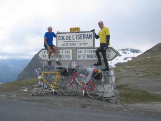
| Bonneval sur Arc | Col d'Iseran |
We stopped for a snack in Lanslevillard, the upper end of Lanslebourg, below the Col du Madeleine (1746m), a short but steep climb into the high valley of the Arc. On the way to Bonneval sur Arc, at the end of the valley, great panoramas of the Glaciers de Evettes on the slopes of the Croce Rossa (3546m), Via di Ciamarella (3676m), and l'Albaron (3638m) open to the east. We stopped for some food in Bonneval sur Arc (1835m) before heading up the Col d'Iseran that starts here with two long traverses to the Gorge de la Lenta, a box canyon that lies south of the pass and from which the road climbs on east wall rising over waterfalls as it passes through bare rock tunnels. Here, above the box canyon, the Lenta cascades into the gorge through a slot. Just above this slot, the road crosses the river on a stone bridge and takes two long traverses in a narrow valley to reach the summit of the Col d'Iseran (2764m).
Although cool climbing air is fine, it doesn't help below a certain level, a level that we seemed to have gone below. The climb went well for a late afternoon but it got windy and cold before the summit where we changed into parkas and hoods pulled tight around the face for the descent to Jean Claude Killy town, Val d'Isčre (1840m) that is so entirely ski oriented that snowfall should be expected any minute, judging from the crowds.
www.paloaltobicycles.com/alps_photos/f20.html
www.paloaltobicycles.com/alps_photos/f83.html
Below Val d'Isčre the road climbs a bit, passe through a few tunnels and runs along the Lac du Chevril before descending to Ste Foy (1051m) and Seez (904m) where we stopped for the day at Hotel Gateau Savoie as I have on many rides in the past. Seez lies at the intersection of the Iseran and Petite St Bernard passes just above Bourg St Maurice.
9. Tuesday, 14 July (Seez - Splügen; 211km, 3756m):
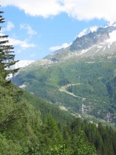
Under a cloudless sky, we coasted down to Bourg St Maurice (840m) and turned north on RT D902 to the Cormet de Roselend. This lovely inconspicuous road climbs through forests into high grassland with great views of Mont Blanc (4807m) and its many glaciers gleaming in the sun. On the way up, still in the forested narrows of the Torrent des Glaciers we passed the non-Hotel Bonneval (1000m) whose five storied stone structure, swimming pool and garage have stood incomplete for as long as I have passed there. This was a great boondoggle, investing in a spa in a canyon that seldom receives sun shine.
| 
|
| Col de la Seigne | Ski Mt. Blanc |
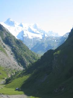
Soon, after a few serpentines, we reached the high valley of La Chapieux (1552m) where the road/trail to Col de la Seigne heads east past the base of Mt Blanc, a route I have taken in weather from sunshine to snow in either direction. The route offers great scenery and is a worthwhile adventure.
We rolled over the Cormet de Roselend (1967m) and descended past the reservoir and its huge concrete dam to reach Beaufort (743m) through the deep ravine and narrows that look like a dam disaster if the dam failed. Just the same, they make great cheese here and have good lodging and food. We were a bit early for lunch so we rolled out of town to St Pierre to head up the Col de La Saisies (1633m).
La Saisies, a typical garish ski town that is practically dead in summer, offered a pleasant sidewalk restaurant where we put away a good lunch before descending to Flumet (917m) and climbing to Megeve (1113m) where we took N212, the higher road, through St Gervais (807m) down to La Fayet (589m). Here we got on the "flying" autoroute that rises on huge columns above the valley on its way to Chamonix (1037m). It now has a "no bicycles" sign but the approved bicycle route looked by all indications like a major hill climbing detour. I have always taken the autoroute and suspect that it is marked the way it is to keep bungling bicyclists away.
After the road leveled off and passed through two tunnels, we took the turnoff to Chamonix. We took pictures of the Bossons glacier across from the rock climbing cliffs where the walls were covered with climbers practicing their art.
www.terragalleria.com/mountain/mountain-image.alps3535.html
tinyurl.com/6d54s
|
| Challet Cauchy Argentier |
While admiring the icy slopes of Mont Blanc, we rode through town and on to Argentiere where we got a better view and stopped by the Chalet of a friend who was away at the time, but we took a picture of us sitting on the bench on his front porch. From here it was a short climb to the Col de Montets (1461m) and across the border into Switzerland. We took the road to Fin Haut (1240m) where the Forclaz pass begins to climb. This route climbs a bit less than the main road and gives access to a restricted road that parallels the adhesion and cog wheel Martigny-Chatelard-Chamonix railway to Martigny in the Rhone Valley. There is NO traffic on this road.
When we arrived in Martigny the usual afternoon wind was blowing up the valley, although in town it was more of a swirl than a directional wind because three valleys meet there. Once we got up the road in the Rhone valley the tail wind was stronger than we expected, so we began to roll. I had forgotten where Susten, my goal for the day was with respect to other towns, so we plugged away at it so we wouldn't waste the opportunity, because tomorrow there would be no wind till about noon. In the morning, a cool breeze even blows down the valley.
We reached Susten at about 7pm, found the my old favorite, the Susten Hotel, dead but found a great substitute, the Rhodania just up the street. After a great and exciting day, we ate well and got a good night's sleep.
10. Wednesday, 15 July (Splügen - Cama; 178km, 2452m):
|
| Simplon |
In cool but sunny weather, we rode past Raron, the south portal of the new 34.6km long Lötschberg base tunnel, that much like the 57km Gotthard tunnel, was producing a huge pile of granite. Meanwhile, high above, the BLS (Bern Lötschberg-Simplon) railway comes out of the old tunnel and descends the granite wall for 15km to reach Brig and the Simplon tunnel. This is a spectacular rail line with tunnels and high stone arch bridges on which just observing trains from below in the valley or seeing the valley from the train is an adventure.
At Visp, we saw where the Matterhorn-Gotthard (FO) railway goes to Zermatt and the Matterhorn from Brig. This is also a great trip followed by a train ride to Gornergrat:
www.bahngalerie.de/bahn/mgb.htm
In Brig Bob got an additional memory card for his camera and we got some food before heading up the Simplon highway that starts climbing on the main street in town. We rode up the new Simplon road that for some reason wants to detour bicyclists into Ried and back on the highway just after a high bridge that passes the town. We stayed on the road as always with no problem. Besides, the new highway offers a greater view of the Rhone Valley than the old road.
At the curved Schallberg tunnel the road enters the Gantertal, high above the Saltina, the river through Brig. About a kilometer farther, on this nearly flat section, we crossed the Gantertal to Berisal (1520m) on a high concrete suspension bridge where the road formerly went around the end of valley through an avalanche chute that made the road impassable in winter.
www.montivagus.de/chpsim.html#bilder
From Berisal we continued in the shade of a larch forest up to tree line where long avalanche shelters cover the road most of the distance to the Simplon summit (2005m). The air on the climb was pleasantly cool but under the hazy sky the Aletsch Glacier was barely visible to the north and the Eiger was out of sight. The Simplon Pass is one of the more exciting and scenic routes in the Alps, because unlike other major passes, it has no highway tunnel beneath it, yet has remarkably little traffic. The north ramp out of Brig seems normal enough but the south ramp finds its way through vertical granite walls and tiny hill towns. Besides that, the north side is German speaking and culture while the south side is Italian.
As always, we stopped at the summit to take pictures of the granite eagle sculpture that stands guard there over the monastery and hotel:
www.picswiss.ch/Land10/VS-10-05.html
Today was a low-traffic day as we swept down into the galleries along the granite walls of the Gondo gorge, high above the Diveria River in the Val Divedro. After a long zigzag down the wall, we reached the small villages of Gabi, Gondo, and finally Iselle (672m) where the 20km Simplon railway tunnel emerges from its south portal only to immediately vanish again into a tunnel that makes a loop in the mountain to lose elevation to Varzo (532m). The Varzo bypass, being built over the Diveria, looked like it was nearly finished last year but seems to be stalled at the moment. The long curved bypass is entirely on a steel bridge over the Diveria.
www.paloaltobicycles.com/alps_photos/s25.html
| 
|
| F. Diviera Crevola d'Ossola | Re Cento Valli |
About a kilometer above Crevola d'Ossola (337m), that lies at the end of the narrow part of the canyon above the Valle d'Ossola, the highway enters an autos-only tunnel where bicycles must (and prefer to) take the old road into town. Shortly beyond the tunnel entrance we stopped at the graceful and ancient stone arch bridge to take a picture of Bob sitting on the railing at the top of the arch as I often have. We turned off at Crevola d'Ossola to cut across the valley to Masera (297m) for a late lunch on this warm afternoon before heading up the Val Vigezzo along the route of the Centovalli railway.
www.schweizer-schmalspurbahn.de/1439696.htm
www.rail-info.ch/FART/fotos.en.html
After the summit at Druogno (831m) it's more or less all down hill to Locarno on Lago Maggiore, but on the opposite shore from where we were a week ago. We had lost the cool dry air of the days before and had the muggy weather common here in summer. We stayed on the west side of the valley as we headed back to Bellinzona and Arbedo (239m) at the bottom of the Valtellina and the Moesa River. We rode up the Valtellina along the branch of the RhB railway that still has tracks but no scheduled service. We found a good hotel in Cama (344m) and ate well.
11. Thursday, 16 July (Cama - Maloja; 129km, 3720m):
Back on the road, we started climbing as we passed Soazza, stopping at the grocery store in Mesocco (777m) before heading up to Pian San Giacomo (1140m) and were disappointed to see that Hotel Beer was permanently closed. The climb to San Bernardino (1607m) where the autostrada enters its tunnel, was humid enough to soak my jersey, but from there onward it got cooler and was a lovely climb along rushing streams.
The monastery on top of the San Bernardino pass (2063m) was as lifeless as ever but toy dogs with miniature barrels of rum under their chin were available at the kiosk. As we crossed the summit, the sky looked like it was getting ready to moisten our day but it held on until we got off the hill at Hinterrhein (1624m) where the autobahn comes out of the tunnel. Looking back as we rolled down the valley to Splügen (1460m), it seemed that rain was trying to catch us. We got some food at the store before heading up the Splügen Pass that started climbing at the road junction in town.
The cool weather and overcast made all these climbs seem easier than on other occasions. I kept my eyes open for dippers, water ouzels, little brown and white birds that nest behind waterfalls and walk under water to pick at bugs in clear mountain streams. Unlike in past, I found none, but retiring as they are I could have missed them.
We got past the Swiss border with a nod and the Italians with a wave as we did all but one time. The Splügen summit (2113m) is not exciting scenery although the south ramp is. After the large granite faced dam beyond Monte Spluga (1920m) and its reservoir, the descent enters snow and avalanche tunnels. In the days before pavement, these were one way tunnels that posed a major hindrance to two way traffic. Some of the old tunnels are still visible along the road. Today most of the tunnels have been rebuilt as two way high clearance bores but a few have not. To avoid this, a new road from Pianazzo (1386m) takes a long route around the end of the valley. We, of course, took the old road with its narrow, stacked hairpin tunnels and sheds that climb spectacularly down the wall.
We descended the Val San Giacomo along the Liro river, while the valley widened and became less steep on the way to Chiavenna (333m) in the Val Bregaglia. Meanwhile, the air began getting stinking summer hot. We turned up the valley toward the Maloja Pass and St Moritz and crossed into Switzerland at Castasegna (696m) passing the lovely old fashioned Post Hotel Bregaglia (820m) at Bondo, Sottoponte, and Promontogno, three interleaved towns. At first it seemed we had outrun the rain but noticed farther up that the rain had not left but just ducked behind the mountain, but as we passed the leaning rock:
www.paloaltobicycles.com/alps_photos/s15.html
the rain returned as we rode to the base of the Maloja Pass in off and on drizzle. The rain stopped again as we climbed out of Casaccia (1458m) to the valley below the serpentines of the pass on the headwall of this box canyon. We reached the Maloja "summit" (1815m) before the rain returned, but by then we were in Hotel Longhin enjoying dinner. We had good room for the night.
12. Friday, 17 July (Maloja - Bormio; 167km, 3248m):
The Maloja Pass (1815m) is one sided with no real descent to the east. Under an overcast sky with patches of blue we rode along the shore of the Silsersee that lies on the summit and is the source of the Inn river. Then we rode along the slightly lower Silvaplanasee and beyond that the St Moritzersee after which the road descends through a narrows into the Val Bernina. We joined the Bernina road at Champagna (1714m) riding south past Pontresina (1805m) and on to the famous Bellavista curve railway crossing (1950m) of the RhB Railway.
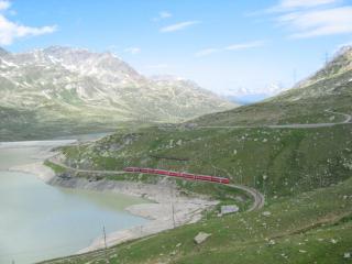
| 
|
| Bernina pass | Bernina pass |
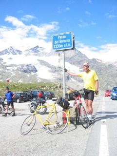
We stopped for a picture, hoping for a red RhB Bernina train in front of the magnificent backdrop of the Morteratsch glacier and Piz Bernina, but no train came. A camera crew was taking pictures of MTB riders, I suppose also waiting for a train. Above here, the Val Bernina is fairly flat but after the Diavolezza and Lagalp funiculars, the road climbs the last bump to the Bernina summit (2323m). Two lakes lie on opposite sides of the divide, where the waters of deep blue Lago Negro flow via the Inn and Danube rivers to the Black Sea, while those of milky white Lago Bianco flow via the Cavaliasco and Adda rivers to the Po and the Adriatic Sea.
www.trainpics.de/gallery/switzerland/ch-bernina/rb17134.html
|
| Lago du Poschavio a Miralago |
The south side of the Bernina Pass is one of the longer descents in the Alps as it makes its way into the Val Poschiavo. A kilometer or so below the summit, we passed the junction (2045m) to the Forcola di Livigno pass (2315m) to Livigno where a tunnel connects to the Ofen Pass and the Eira (2210m) and Foscagno (2291m) passes connect to Bormio.
The weather was more like April so that we were in sunshine on damp roads and under clouds on dry ones but didn't get rained on. After a swift descent to Lago di Poschiavo (962m) we rode around the lake and got a beautiful shot of the Bernina reflected in a glassy smooth lake. Descending to Brusio, we stopped at Hotel Bottoni for a visit with the owners and had a large dish of their special gelato. Well fueled we passed the famous Brusio Loop of the RhB railway and crossed into Italy at Campocologno where we were detained for a long passport investigation in which we seem to have been OK, since no further questions were asked. We just seemed to have had the luck of the draw.
www.rail-info.ch/RhB-BB/pics/rhb5374.jpg
At Madonna di Tirano (430m), we turned south and, after few kilometers, crossed the valley to Stazzona and the road up through the woods to intersect the Aprica Pass road (Rt N39). From Aprica (1176m) on the summit, we descended the long gentle grade to Edolo (690m) where we stopped for lunch. Under sunny skies, we passed the foot of the Mortirolo Pass (1896m) at Monno (868m) and stopped in Temů (1144m), just below Ponte di Legno, to visit friend Silvano Macculotti, proprietor of the Locanda Veduta dell'Adamello hotel.
| 
| 
|
| Passo Gavia | Passo Gavia | Passo Gavia |
We rode through Ponte di Legno (1258m) along Torrente Frigidolfo staying on the north side of the river to reach the nearly flat, lush green valley. The first climb to the Gavia begins below Pezzo (1565m) a typically picturesque hill town, glued to the side of the mountain. We climbed through the larch forest to break out to Appolonia (1585m) where the Frigidolfo meanders across the valley with no hint of its cascades below, or waterfalls above.
I stopped at the gazebo to get a sip of the rusty bubbly mineral water to seek its benefits masked by its foul flavor. This water is thought to give strength to bicyclists who dare climb the Gavia or at least to those who dare to drink. After getting past the warning signs of landslides, rockfall, dangerous narrow road, and a requirement to have tire chains on board from September to July, we were on our way. Past the second hairpin, reality strikes as the road goes from highway to one-car width, and the 16% sign of poster fame sets the tone. The road is only that steep in a few places, but the signs are a warning for vehicles that cannot restart on such a grade after meeting a descending vehicle. Bicyclists can always walk.
I stopped at the cliff, the scene of the poster picture of 1978 on display in the Rifugio Bonetta on the summit. In many attempts I have not been able to match that photo.
We stopped in at the Rifugio to say hello to Signor Bonetta. As last year, there was "mail" taped to the glass on the poster with a greeting from a fellow bikies. We thanked Sig. Bonetta for his hospitality and rolled off across the broad summit.
www.waltellina.com/ortlescevedale/bonetta/
www.webcam.valtline.it/valfurvag.htm
As we crossed the summit, the Ortler (3905m) and Gran Zebru (3851m) with their glacial caps and perpetual glistening snow rose to the east as we descended into the Valle Valfurva. The Val di Gavia got steeper as we passed Rifugio Breni (2543m) on the way down to the main road in Santa Caterina (1734m). Valfurva Valley is a steep dash from the town of Valfurva (1339m) to Bormio (1197m). We rode along Via Roma, a pedestrian mall and main street of Bormio, and found a suitable hotel in lieu of my old favorite, the Hotel Ignazio, that ceased operations after all these years.
13. Saturday, 18 July (Bormio - Vigo di Fassa; 162km, 3128m):
| 
|
| Passo Stelvio | Passo Stelvio |
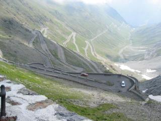
After a hearty breakfast and well rested, we rode up the rocky Val Braulio, where the road follows the south side below slopes of scree, ducking in and out of a series of long avalanche tunnels before reaching the headwall at Spondalunga. Here the road makes ten traverses to climb to the Bocca di Braulio (1908m), a curved valley that leads to the Umbrail gap (2502m) and the Stelvio summit (2757m). >From the Umbrail, the last 3km are a steady 10% climb.
www.paloaltobicycles.com/alps_photos/i79.html
As usual, many motorcyclists and bicyclists were gathered at the summit in bright sunshine. We took pictures at the east edge of the gap of the road whose serpentines are glued to the wall as it starts down the 48 hairpin turns to the Val di Trafoi. Today the road was a string of bicyclists competing in a hill climb from Prato. I was told that good elapsed times were around an hour and a half for this event.
tinyurl.com/agnvh
tinyurl.com/9ah2r
We got splendid views of the Ortler and its glaciers on the way down to Prato. In Spondigna across the Val Venosta from Prato, we crossed the tracks of the newly refurbished FS railway line that had been abandoned a few years earlier. Although we had a slight headwind we rolled easily down the Val Venosta to Merano (320m) where the huge Forst brewery marks the city limit.
With many new roundabouts, the old route from Merano to Bolzano (262m), a mostly flat 30km down the Val Venosta was no longer obvious. At every new roundabout, directional signs pointing to Bolzano led us to the autostrada. Finally I started following my nose and best guess, which got us to town and on the route I wanted. Other than that, traffic was light as we headed north past the Bolzano train station in the Isarco (Eisack) Valley to Cardano. At Cardano we climbed through a 1.2km curved tunnel with a moderate grade that was well lit, had good ventilation and broad shoulders on Rt N241. In spite of the new tunnel the best scenic part of the Ega canyon remained in tact although the tunnel skirts most of the 16% defile for which the Costalunga road was noted.
www.paloaltobicycles.com/alps_photos/i92.html
At the upper end of the tunnel where we joined the old road, we could see the amazingly steep closed old road in the narrows below. I believe this is an improvement for everyone because the most scenic part of the canyon remains unchanged. We rode on through Welschenofen (1182m) and into the forest above where just beyond Hotel Diana the road levels off. Here in the summit meadows lies the turquoise Lago di Carezza, the reflecting pool for the Latemar (2842m) with its myriad Dolomite spires, but haze shrouded its peaks that would have reflected in the lake.
|
| Passo Costalunga Rosengarten |
Although it was sunset, the partially visible Rosengarten (2981m) was not glowing in its famous red evening light under the overcast that robbed it of its sunset colors, the ones that give it its name. We passed the junction with the Nigerjoch Pass, whose lower end is the 24% grade road to Tiers. After a short climb with a few turns we reached the Costalunga summit (1745m) followed by a long gradual descent to Vigo di Fassa (1380m) where we stopped for the day at the Hotel Cristallo.
A short descent brought us to the road up the Val di Fassa where we rode to Canazei (1460m) and started up the Pordoi Pass with the usual morning rush, a continuous column of cars with vacationers heading for the passes after breakfast. This surge is over by about nine o'clock after which the roads are fairly empty. As we got near the top of the Pordoi (2239m) the full panorama of classic Dolomite peaks came into view. We chose not to take the loop of the other three passes around the Sella group in order to have time for more of the eastern areas.
Riding high above the Cordevole creek in the Livinallongo valley to Pieve (1470m) we had a broad panorama to the south. At the end of this valley, at Cernadoi (1495m), we started up the Falzarego pass (2105m). The road is surrounded by strikingly beautiful Dolomite peaks and cliffs as it winds through tunnels and over masonry revetments. The Falzarego (2105m) lies in a beautiful meadow at the base of Pizo Lagazuoi (2770m), a striking dolomite peak below which the Valparola Pass (2192m) heads west into the Val di San Cassiano.
We had a view of many great peaks to the south including the Cinque Torri that I have had the pleasure to see under thunder clouds with break that illuminated the five spires with a dark backdrop. We descended from the Falzarego to Pocol (1480m) above Cortina, at the junction with Passo Giau. After a hearty lunch on the deck of the restaurant at Pocol, we continued toward the Giau, first descending and then climbing the odd alignment of this ancient road.
| 
|
| Passo Giau | Monte Pelmo Passo Staulanza |
Under cloudy skies, the scenery was magnificent as we reached the summit of the Giau (2236m). We saw little across the Valle d' Ampezzo and the Passo Tre Croci to the north but the Marmolada, Monte Civetta (3220m) to the southwest were beautiful. On the descent down the Codalunga to Selva di Cadore we passed Rifugio Piezza (2175m), a half kilometer below the summit, with great dining... and stay for the night. At Selva (1336m) we headed east to the Forcella Staulanza (1766m) along the Torrente Fiorentina, all the while heading straight for Monte Pelmo (3168m). The Staulanza is an easy pass and comes as a surprise because there is no apparent gap past Monte Pelmo. After a hairpin turn just before the mountain, and a couple of ess-curves, the pass shows up unexpectedly,
Typical of the Dolomites, this route is a scenic wonder. We descended to Longarone (472m), notorious for the dam disaster at 22:42 on 09 October 1963, when the town was destroyed by a "tidal wave", that a landslide from Monte Toc (1921m) had forced over a dam and through a narrow gulch across from the town, claiming 1909 lives. Our hotel as, most in that area, displayed many before-and-after pictures. A memorial church designed by Le Corbusier stands in the center of town and a similar chapel, above the dam.
14. Sunday, 19 July (Vigo di Fassa - Longarone; 133km, 3000m):
A short descent brought us to the road up the Val di Fassa where we rode to Canazei (1460m) and started up the Pordoi Pass with the usual morning rush, a continuous column of cars with vacationers heading for the passes after breakfast. This surge is over by about nine o'clock after which the roads are fairly empty. As we got near the top of the Pordoi (2239m) the full panorama of classic Dolomite peaks came into view. We chose not to take the loop of the other three passes around the Sella group in order to have time for more of the eastern areas.
Riding high above the Cordevole creek in the Livinallongo valley to Pieve (1470m) we had a broad panorama to the south. At the end of this valley, at Cernadoi (1495m), we started up the Falzarego pass. The road is surrounded by strikingly beautiful Dolomite peaks and cliffs as it winds through tunnels and over masonry revetments. The Falzarego (2105m) lies in a beautiful meadow at the base of Pizo Lagazuoi (2770m), a striking dolomite peak below which the Valparola Pass (2192m) heads west into the Val di San Cassiano.
We had a view of many great peaks to the south including the Cinque Torri that I have had the pleasure to see under thunder clouds with break that illuminated the five spires with a dark backdrop. We descended from the Falzarego to Pocol (1480m) above Cortina, at the junction with Passo Giau. After a hearty lunch on the deck of the restaurant at Pocol, we continued toward the Giau, first descending and then climbing the odd alignment of this ancient road.
Under cloudy skies, the scenery was magnificent as we reached the summit of the Giau (2236m). We saw little across the Valle d' Ampezzo and the Passo Tre Croci to the north but the Marmolada, Monte Civetta (3220m) to the southwest were beautiful. On the descent down the Codalunga to Selva di Cadore we passed Rifugio Piezza (2175m), a half kilometer below the summit, with great dining... and stay for the night. At Selva (1336m) we headed east to the Forcella Staulanza (1766m) along the Torrente Fiorentina, all the while heading straight for Monte Pelmo (3168m). The Staulanza is an easy pass and comes as a surprise because there is no apparent gap past Monte Pelmo. After a hairpin turn just before the mountain, and a couple of ess-curves, the pass shows up unexpectedly,
Typical of the Dolomites, this route is a scenic wonder. We descended to Longarone (472m), notorious for the dam disaster at 22:42 on 09 October 1963, when the town was destroyed by a "tidal wave", that a landslide from Monte Toc (1921m) had forced over a dam and through a narrow gulch across from the town, claiming 1909 lives. Our hotel as, most in that area, displayed many before-and-after pictures. A memorial church designed by Le Corbusier stands in the center of town and a similar chapel, above the dam.
15. Monday, 20 July (Longarone - Tolmin: 183km, 1800m):
We crossed the valley and rode up the granite wall through tunnels up to the dam that still stands undamaged above Longarone. Below, leading up to the lower face of the dam, the old, pre-dam road notched and tunneled into the vertical wall of the gorge is amazing and a road I would like to have ridden. The dam is about 50m across but at least three times that high, narrowing to almost nothing at its bottom.
tinyurl.com/li6o (before)
tinyurl.com/li6e (after)
www.wineathomeit.com/vajont2003/eNGLISH/bbc.vajontBhopal.html
After the last tunnel we emerged just above the dam that still has a bit of water between it and the mountain that slid into the former lake. This water is piped under the slide from the tail end of the lake formed by the dam. A memorial chapel by Le Corbusier stands vigil over this disaster scene.
www.vajont.net/dopo/chiesa.html
www.geocities.com/TimesSquare/Hangar/4415/Maurizio/vajont.htm
www.geocities.com/TimesSquare/Hangar/4415/Maurizio/vajont1.htm
www.citysite.it/news/page/fotonews/vajont/diga.htm
Beyond the dam the road climbs over the mountain that slid into the lake and descends to Erto (750m), a small town on the far side of a small pass above the former reservoir.
We crossed the Passo di San Osvaldo (827m) to a region that doesn't see much traffic or tourists. The river beds are striking with their brilliant white dolomite stone and azure green water with such clarity that the edge of the water is hardly discernible as its color vanishes to white on the shore. In Barcis (409m) along one of these rivers, the Torrente Cimoliana that flows into the Lago di Barcis, a brilliant emerald in this beautiful landscape.
The lake drains past a dam into a narrow gorge that was a great scenic adventure but is permanently closed now that it is flooded by a new dam. I had last ridden through this fascinating tunnel like road years ago but that is no longer possible. Instead we rode through a one kilometer tunnel and a short open section before entering a four kilometer tunnel whose lower end was above the lake behind the new dam just above Maniago (283m) that lay over a small ridge.
We looked at the downstream side of the dam as we continued to Pinzano (104m) and stayed in the hills instead of taking the main route to Tarcento. This route was a bit circuitous but scenic and sometimes disorienting, so we had to consult our maps now and then. Crossing the Tilment River, we reached Gemona (272m) and headed south to Tarcento (230m) where Rt 646 heads east into Slovenia. This is a pleasant road along the Torrente Torre, gradually climbing to the low Passo di Tanamea (848m) a few kilometers before the border.
|
| F. Soca Slovenia |
The border crossing was a wave of the hand as we rolled down to Zaga on the Soca River where we turned south to Tolmin (200m). This is an interesting town for me, having seen it in the days of Yugoslavia when it was a military camp with training soldiers ever on local maneuvers. It was as close as I got to life behind the iron curtain. The atmosphere was "hard times" with practically empty shelves in food stores and few older cars on the roads that carried mostly agricultural and and military traffic.
Today there is no sign of the barbed wire and barracks and the food stores are well stocked. It is basically western Europe with an upbeat attitude. We found a comfortable hotel that in spite of its four starts was moderately priced and had a great menu. I had not stayed here before but it was a pleasure to close the communist chapter this way at the Pension Rutar.
16. Tuesday, 21 July (Tolmin - Obervellach: 185km, 756m):
We started with a clear sky as we rode up the Baca river toward Podbrdo (525m) where we planned on taking the tunnel train through to Bohinjska Bistrica. I managed to do this last year, remembering the previous tours where we rode over the top (1500m) of un-named small roads with no scenic value. We got to the tunnel that became 100 years old this year, about a half hour before the train and got something to eat at the grocery store. At 10:45 the train arrived, a few waiting autos rolled onto the flat cars as we joined several other bicycle tourists who were already on the two axle passenger car that was 1/3 bicycle hanger racks.
We got off in Bohinjska as the train loaded for its return trip to Tolmin. We rode past Bohinjska lake and down the valley along the Sava Bohinjska to Bled (504m) on beautiful Blejsko lake where Marshall Tito's elegant but modest vacation residence is still in fine shape, although fenced off and unused. Below Bled we got on the state route to Jesenice (574m), parallel to the motorway that takes most traffic, leaving us with only light traffic.
After Jesenice, where the motorway turns north to Austria, traffic was even lighter as we stopped in Gozd to take a better picture than the one from years ago. The only problem was that the city limit sign, in the old picture, had been placed elsewhere. This route is surrounded by the eastward extension of the Dolomites, known as the Karavanka typified by the view of Gozd.
www.paloaltobicycles.com/alps_photos/a46.html
|
| Wuerzenpass |
We followed the Sava Dolinka river up the valley to Podcoren (810m) at the base of the Würzen Pass (1073m) that connects to Villach Austria. I hadn't tried this route before, having noted that it includes 18% grades but considering the altitude change we decided that this was a good route after all. The map was correct and in two 200m sections the road climbed at 18% but with moderate grades otherwise.
The real surprise was the descent that right from the top has a large sign showing a gear shift gate with a fat red line going from 4th to 1st gear and a picture of a car tilted forward at 30 degrees. The sign also announced 18% - 500m, a significant distance, especially as curvy as it was. This section ended at a hairpin turn with a runaway escape road exiting at the apex of the turn. We stopped with rims so hot we felt it advisable to not continue until the rims cooled.
This brings to mind the Zirlerberg pass that for good reasons prohibits downhill bicycling besides having several runaway escape roads, a road we would see the next day as we passed Innsbruck.
We descended into the Gailtal and rode through Villach (501m) to head up the Drau river to Möllbrücke (557m) where we headed up the Möll river toward the Großglockner Pass stopping at Obervellach (680m).
17. Wednesday, 22 July (Obervellach - Wald: 152km, 2160m):
We got a good start up the Mölltal with cool air and puffy clouds. Traffic was light as much traffic after Spittal goes over the hill here on the Autobahn to Salzburg and train to Mallnitz. The road gradually gains elevation and turns the corner to the Glockner at Winklern (958m). From here it's a gradual climb along the Möll up the narrow and scenic valley toward the Großglockner, the highest peak in that Hohe Tauern range, that gives its name to the toll road, "Großglockner Hochalpenstraße". We could already see the glaciers of the Glockner above the end of the valley as we climbed.
| 
|
| Mölltal | Heiligenblut |
At Heiligenblut (1301m) at the foot of the Großglockner Pass, the end of an easy cruise up the valley with a bit of climbing here and there we stopped for a grocery store lunch. The grocery store on the corner is open every day all day so that tourists can get what they need. As we put away our fuel for the big climb we could see the Großglockner behind the tall slender church steeple of Heiligenblut.
The real climb starts in front of the grocery store with a 12% grade that lets up a couple of times before the saddle at Kasereck (1913m), a restaurant and large cheese factory, after which the road descends to the junction where the scenic road to the base of the Großglockner and the road to the summit split.
The Dolomites to the south were no longer visible as we reached, Hochtor, the summit (2505m), in breezy pleasant temperatures with rain chasing us up the climb. We rode through the 200m summit tunnel and down passing the lake before Mitteltörl (2328m) ,a curved tunnel (the middle summit), and down a short 12% grade that took us to a 12% climb to Fuschertörl (2428m, the north summit). With a clear sky to the west, the whole Glockner group made a striking panorama. We descended the 12% run to Fusch in the Fuschertal and continued to the north toll gate at the bottom of the grade at a wildlife park at Ferleiten.
We rolled down to Bruck (757m) on the Salzach River, passing through villages with roadside displays of wood carvings and rustic furniture, Austrian art for the tourist. Across the Salzach we passed through Zell am See as we headed west up the Pinzgau Valley past Mittersill where most traffic heads north to Kitzbühel or south through the Felber-Tauern Tunnel to Lienz and the Dolomites. After Mittersill the road was fairly empty. The Pinzgau narrow gauge (760mm, 30inch) train tracks run parallel the road much of the way here.
|
| Gerlos lake |
We continued west to Wald (867m) at the foot of the old Gerlos Pass where we took the old Gerlos road by cutting across the church yard after the grocery store to head up the hill. We stopped at Gasthaus Grubl, a great place to stay, run by Mrs. Kaiser. The hotel lies in a crook in the road, where a small creek runs over a decorative water wheel that once drove a generator. We enjoyed a good dinner along with a group of Motorcyclists who found this a convenient spot for the night. The rain never caught us.
18. Thursday, 23 July (Wald - See: 185km, 1524m):
A good buffet breakfast prepared us for the 400m section of 17% that starts at the front door of the Gasthaus Grubl. We said good by and got warm quickly in spite of the cool cloudy weather. We got a bit of rain before we got to the top of the old Gerlos Pass (1486m), though the road was mostly dry over the summit where it joins the new road. We seemed to be ahead of the rain because the road was dry as we descended past the huge earthen dam to Gerlos (1245m). From here, The road stays high while the Gerlos River rushes down the Gerlostal, a narrow defile. From Hainzenberg (1000m), the road finally takes a series of hairpin turns to descend to Zell am Ziller (575m) in the Zillertal.
|
| Innsbruck goldene Dach |
We took the small road down the east side of the valley, crossing over near Strass (520m) as it started raining. The daily steam Zillertal train was just getting ready to leave as we headed west toward Innsbruck (574m) along the south side of the Inn, crossing to the north bank at Hall. From Hall to Innsbruck, the old streetcar line on the south side of the highway has become an excellent bicycle path that took us into town. We took the road around the west side of town along the Inn and dropped in on the old city center to catch the local color. The balcony with the golden roof was in fine trim as were McDonald's golden arches a few houses down the narrow street.
www.die-seite.at/sight/goldenesdachl/goldenroof.php
We stayed on the south side of the Inn toward Vols, on the less traveled route toward Landeck. Across the river, the railroad, on the way to Garmisch-Partenkirchen and Munich, traverses the vertical Martinswand, a huge curved granite wall through in tunnels with a few windows. More striking is the Zirlerberg road with a 16% grade up to the roundhouse restaurant and from there with up to 22% to the top. Bicycles are prohibited from downhill use of this road that has six runaway escape roads for motor vehicles.
Our road remained fairly flat until Haiming, the mouth of the Ötztal, from whose upper end the Timmelsjoch (Passo Rombo; 2474m) crosses to St Leonhard and Merano in South Tyrol. With mini-markets at most gas stations along this route, we were well supplied with food and drink. We crossed the high bridge over Ache River from the Ötztal and crossed to the north side of the Inn to climb two kilometers over the narrows of the valley.

|
| Silvretta Dam |
After the climb and a two kilometer descent, we turned off to Bahnhof Imst and the river rafting set-in to take the bicycle path to Landeck. The path lies between the autobahn and the river, avoiding the climb to Imst and Imsterberg that the local highway makes. At Landeck (816m) we took the Arlberg highway (Rt N1), and turned off at Pians into the Paznauntal and the Silvretta Hochalpenstraße (toll road Rt A188), the Bielerhöhe Pass to Bludenz in the Montafontal.
The Silvretta road drops down into the Sanna River and heads up the Paznauntal along the Trisanna River, passing under the high railway bridge of the Arlberg Line. These are much sought after white water rivers.
tinyurl.com/88kdz
tinyurl.com/ex948
We stopped at See (1025m) under cloudy skies hoping for a brighter day tomorrow for the Silvretta group at the summit.
19. Friday, 24 July (See - Mitlödi: 182km, 576m):
We had a light tailwind up this gradual climb along the Trisanna River to Galtür where road gets steeper up the desolate valley but to make up for that it rained and drizzled most of the way. The last kilometer to the dam of the summit lake of 12% got us to the Bielerhöhe Pass (2021m). The Silvretta lake straddles the summit and is contained by an earthen dam on the east and a concrete dam on the west. Under a solid overcast, we could see only the lake and the base of the glacier-covered Eckhorn (3117m), Wiesbadenerhöhe (2490m), Piz Silvretta (3248m), and Piz Buin (3312m). The English rowing team was again present using high altitude training for the eight-man crew Olympic team.
The descent down 32 hairpin turns to Partenen (1027m) is easy because there are no tight turns, all of them being gentle sweepers. To make up for that, it has grades up to 11%. From the bottom of the steep part, in Partenen (1051m) on the Ill River in the Montafontal, we rolled down to Schruns (690m) and on to Bludenz (559m) and Feldkirch (455m) in the Rhine valley.
From Feldkirch (455m) we headed south and crossed to the west bank of the the Rhine past Vaduz, the capital of Lichtenstein and on to Sargans (482m) Switzerland. Although not raining, we had a low overcast so that not much above the Walensee at Walenstadt (427m) was visible. We took the bicycle path along the lake, stopping for a grocery store lunch There being little to see, we skipped riding the Kerenzerberg over the corner into canton Glarus and continued along the lake through two long bicycle tunnels and some steep paths that took us into canton Glarus at Nafels (436m).
www.picswiss.ch/StGallen/SG-l4-04.html
After Glarus (472m) traffic dwindled to nothing as we arrived in Mitlödi at hotel Horgenberg for the day. We had an excellent dinner with the house specialty that could be called the Swiss equivalent of a pizza. With selected toppings a pizza of mostly delicious cheeses with some toast is served on a large platter. It was so good, I didn't want to diminish the good taste with a sweet desert.
20. Saturday, 25 July (Mitlödi - Willigen; 137, 3360m):
We rode up the rest of Canton Glarus under beautiful clouds in a blue sky with the highest peak, the glacier capped Tödi at the end of the valley. The road doesn't climb steeply as it heads for Linthal (662m) at the base of the Klausen Pass, something that is evident by the SBB rail line also going there. In Linthal, the road turns into the wall of the canyon and begins its zig-zag climb into the high valley above, the Urnerboden, that belongs to canton Uri by a quirk of border demarcation.
This climb may be tiring to someone who doesn't know how far it climbs because only the valley below is visible, not the top of the climb. Once in the Urnerboden, the road gently rises to Port (1372m) before once more climbing walls up to the Klausen Pass (1948m). The upper part of this pass is spectacularly scenic as it passes through the U-shaped Urnerboden and climbs the granite walls at the head of the valley. My experience has always been that the mountains look extra high here because their tops vanish in the clouds. Today was no exception.
The top of the pass is fairly flat and starts its descent gradually as a glorious panorama to the north opens underscored by the Schächental, a box canyon that drops off precipitously shortly after the summit. The road clings to the edge passing through tunnels as it gives vertical views of roofs of farm sheds nearly straight below as the Staübifall traces its route from the Tödi glaciers to the lip of the canyon from which it is blown to mist before reaching the valley.
We stopped at Posthaus Urigen for lunch and a hello to Stefan and Karin Truschner who run the place. Although they had a full house for lunch Stefan complained about the cool weather. We ate under umbrellas outside as the Postauto came by giving its famous three tone bugle salute.
| 
|
| Schächental | Schächental |
After a short dash to the bottom of the Schächental (995m) there is a little climb before the stretch down to Altdorf and the statue of William Tell and son. Because the weather was so great we decided to ride over the Susten Pass again to appreciate the glacier highway of the Alps. I guess training helps but it felt easier this time than the first a few weeks ago, or maybe it was just the beauty of the landscape that made it feel that way.
The Steingletscher was at its magnificent best, its top vanishing up the Sustenhorn into the puffy white clouds. All the many glaciers were glistening in sunshine as we came out of the Susten Summit tunnel (2224m). In warner air the descent seemed to roll faster as well, but then there was no headwind this time. We crossed the Haslital at Inertkirchen (625m) and over the four turns of the Kirchet to Willigen (620m) where we stopped at the Hotel Tourist, one of my old favorites.
21. Saturday, 25 July (Willigen - Vitznau); 100, 750m):
We rolled down hill to Meiringen and took the road to the Brünig pass that connects to Lucerne. This is a pleasant forested climb that has a kilometer of 13% in the middle but is otherwise nice. Before the top, it gives a panorama of the Aar valley and the end of the Brienzersee. The SBB cogwheel/narrow gauge railway crosses the summit together with the road although the railway has only a 10% grade.
| Pilatus |
The ride to Sarnen is interrupted a few times by Autobahn construction and detouring tunnels. After descending from the Lungernsee, both the road and railway level off in Giswil (485m) before the Sarnersee. We rode down to Alpnachstadt (435m) where we took the Pilatus cogwheel train (world's steepest) to the top of the mountain for the experience and its great views to all sides.
de.wikipedia.org/wiki/Bild:Pilatus_Zahnrad.jpeg
From here, it was a short ride into Lucerne where we gave the downtown or appraisal, watched the Alpine Swifts circle their tower on the historic wooden bridge and visited the Lion:


This as many places here, is a wonderful place to visit with many attractions in the city and nearby.
We rode around the Lake to Vitznau, the locale of Nicklaus Riggenbach's first Cogwheel railway. We watched the lake steamer with its articulated side wheels dock on its course around the lake and settled in for a last night on the road. In the morning we rode along the lake to Ibach our starting place and packed the bicycles for travel. Bob, leaving the next day and I a week later.
Many of the places mentioned in this report can be seen at:
www.paloaltobicycles.com/alps_photos.html
That was 3350km and 54100m climbing.
If you know of a repository of my ride reports between 1960 and before 1990, or know where I can find them, in software or hard copy, please let me know. I lost these reports when switching from a terminal and server to a PC and failed to retrieve them before they were archived somewhere. That was in the days when there was only one newsgroup on usenet called rec.bicycle.
Jobst Brandt
jobst.brandt@stanfordalumni.org
Palo Alto CA