
For Trento, the place where I live, the choice of most local bikers would fall on the Santa Colomba trail. Easily doable starting from the town, not really difficult but with some challenging sections, it offers a small selection of the standard ingredients of an off-road ride. Mind you, it is not a spectacular trail, such as the ones you can find higher up in the Dolomites. But it's an excellent choice for a half-day ride, which means that on Sunday afternoons you have to line up to ride it! I though it appropriate to post this Ur-Trentonian report as a celebration for three years of the Trento Bike Pages.
I've done this trail so often, that I have a story to tell about each and every rock on it. So I hope you won't mind a few anecdotes.
Mount Calisio has been widely exploited in the past for its silver mines. In April 1997 I attended an excursion into one of the mines, organized by CAI-SAT. This was quite an experience, but I suggest you don't do it on your own, but go into it with experts.
The trail is covered by the Kompass Maps Trento-Lévico-Lavarone (1:50000) and "Altopiano di Piné" (1:35000). There is a 1:30000 "Carta Turistica e dei Sentieri" of Trento published by Comune di Trento and CAI-SAT, and the Cognola/Civezzano section of CAI-SAT has a very detailed (1:15000) map of Mount Calisio. The latter carries also a wealth of information (in Italian) about the area, from the geological, to the historical, to a description of the local flora and fauna.
An alternative is to proceed straight ahead from the gate on the pedestrian crossing, take the small road on the left of the newsstand, avoid the road to the right, and proceed straight up on the steep paved road. You may need to be quick in warming up to manage this one. You rejoin the narrow paved road mentioned above, and keep pedaling up the hill.
One way or the other, you reach a Pizzeria which is rated as one of the best in Trento, and then on passing a(nother!) church take the narrow road to the right, which overpasses a bypass. The construction of the bypass has relieved Trento of much traffic, but has all but destroyed the network of tiny country lanes on these hills. The road we are riding now is the only one left. On reaching a wider road, one keep motoring up, turning left, and soon reaches a roundabout in Cognola, a suburb of Trento. One possibility here is to ride straight ahead and reach on a comfortable wide road the village of Villamontagna ("the Villa on the Mountain", or something). The first time I rode this trail I did this, and ended up bonking under the merciless sun of that hot summer afternoon.
It's here that I had a potentially dangerous accident a few years ago. I was coming down from this very trail. It had rained all day, and the road was wet, and dirty with mud and gravel. I'll never know what I did wrong, but I managed to lock my rear wheel while taking a sharp left turn downhill; next thing I know I'm hitting the asphalt, while my bike flies away in the fields. Luckily I was heavily dressed, and I hit the pavement with all my right flank at the same time, thus distributing the impact on a wide surface. Later, under the shower, I had to pick up a few small stones that had found their way under my skin...
To have a taste of what's in store, however, you may take the narrow road that climbs sharply ahead and to the left, just before Tavernaro's main square, and earn your way up on the very steep (but paved) road until you reach Villamontagna. In the main square, where the bus stop is, it is advisable to take a break, rest on a bench, and drink the cold water from the stone fountain.
Now brace yourself for the hardest part of the trail. It will be short but demanding, and then it's all fun afterwards. Start ascending from Villamontagna's main square, but turn left soon where a white-red SAT signpost points to "Monte Calisio - Le Pozze". Please ignore the sign pointing right to "421 - Lago di Santa Colomba - Campel", as this is the path we will be following on our way back. You can also safely ignore a quite menacing sign pretending that the road we are taking is closed because of landslides.
Anyway, manage this one, but when the ascent eases up the road-bed turns to uncomfortable cobblestones, with a thin gravel film on it. You'll have to work carefully here, and it's still up. As you pass Casagrande ("The Big House"), the road-bed turns into an acceptable gravel, and the problems are over.
However, a double murder had been committed not far from there a few days before. Now rumors were that a mountain biker had been seen in the vicinity. So they were checking us all. The point was, of course, that this trail is ridden by hundreds of bikers every week... In April 1997 a man was sentenced to 30 years for the murder. The prosecution argued that he ran downhill all the way to town after the murder, to meet some friends for lunch, thereby creating an alibi. So the killer qualifies as a hiker, not a biker.
![[Download Pic of Trail]](Hit_the_Dirt.jpg)
The trail eases as you hit the dirt. Note the dry stone wall
From the Rifugio (which was closed in 1997) you have a view on Trento. The motorized traffic noise coming up from the town is striking.
The section ends at a closed gate, a few metres uphill from Rifugio Calisio. You have then to take the trail that ascends mildly on the left.
On the way back, you may want to retrace your steps to ride this section downhill. It is sheer speed pleasure, and then you have several hairpin switchbacks to train your skills.
You have a view on the left to the North, as we have been riding on an arc around Monte Calisio, and then we find trail #430 joining from the right. This would also lead us to the top. After a descent on cobblestones, we reach a brief stretch that is open to car traffic, with a small parking lot for hikers. Avoid the road to the left, leading down to the town of Montevaccino, and take the ascent to the right along trail #420, Strada Forestale Monte Corno ("Mount Horn Forestry Road"). This requires some effort, but the roadbed is usually good, and you will find the necessary grip even with slicks.
The trail is more or less obvious, when not marked. Always follow the direction to "Santa Colomba". There is an ascent made mildly annoying by some rocks, then some nice descents on which you can ride on the elevated side in the turns to maintain speed. Just take care of blind turns: there are always hikers, and other bikers, around here, even on weekdays.
There are some wet zones that can be slightly treacherous or at least inconvenient, as one comes close to the lake. There are usually (dry) escape routes on the border of the trail. When I last rode this trail, in the Summer of 1997, I found that some of these wet zones had been reclaimed through proper maintenance work, and some others were not-so-wet, probably because of the very dry season we were experiencing. The Fall of 1997 and the following Winter were exceptionally dry too. In the Spring of 1998 the rain finally came, and most of the former wet zones became wet again, although they were indeed better than they used to be before the maintenance work.
![[Download Pic of Limekiln]](Limekiln.jpg) At a crossroads one finds a "calcara", or limekiln. This has been
recently restored by a local section of
CAI-SAT. Refer to the information on the aforementioned SAT map for interesting details.
At a crossroads one finds a "calcara", or limekiln. This has been
recently restored by a local section of
CAI-SAT. Refer to the information on the aforementioned SAT map for interesting details.
Later, at a fork, one takes right, goes around a gate, and rides on a mildly ascending doubletrack under a thick canopy of trees. I like keeping speed up here, but watch for some treacherous roots, and again be aware that hikers might be around that turn. We are now very close to the lake.
The final ascent to it is very difficult indeed, as it involves climbing around or on biggish boulders. With some care, you can manage it on your way back. My solution is to ignore the sign pointing to "Lago di Santa Colomba" now, and to ride straight ahead along a trail that runs narrow among the grass first (nearly a "half-track": watch out for the roots), and then widens. It's a bit rough at spots, but not really technical, more on the entertaining side. On reaching a sealed road, take it (uphill) to the right, and you will soon reach the lake.
![[Download Pic of Woods near the Lake]](Woods_near_Lake.jpg)
The woods near the lake have a vaguely Northern European look
The lake is small but quite nice. The woods around it have a good reputation for mushrooms. I normally avoid the restaurant and ride to the other side, where I have my muesli bar and banana, and don a windbreaker in preparation for the descent to town, if the season so requires.
![[Download Pic of Lake]](Lake.jpg)
A view of the lake from my favourite hangout
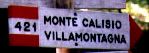
Retracing your steps is straightforward, but take care to stay on
trail #421 ("Villamontagna/Monte Calisio") at the critical intersection. The sign (displayed with the title of this report) is virtually
invisible going back, and I nearly it missed when doing the trail on
September 12 1997, when I was doing a refresher ride before polishing
the final version of this report. It comes after a downhill section
with some rocks, then an easy downsloping section and a right turn.
You can hammer all the time from here on. There are some nice, mildly challenging downhill stretches on the way back. Take care in the rock-strewn sections : perhaps keeping speed somewhat up minimizes the risk of being sent off-trail by vicious biggish stones ("death cookies"), but you'd better be confident in your means here. The final section in the forest, with wide, fast turns, is really fun. You find some concrete-sealed section towards the end, before getting out of the woods at "Rifugio Campel", an easy weekend target for Trentonians. On a clear day, the view on Trento is not bad from here. The steep concrete road leading down to the square of Villamontagna is treacherous, with its rough rain ruts: I've seen bikers going over the bars here. From Villamontagna it's just a matter of retracing one's steps to town. Total time for me is about three hours, including two or three brief stops. Keep in mind that I'm sloooow, though.
![[Download Pic of Castello del Buonconsiglio]](Castle.jpg)
![[Download Pic of Ascent on Cobblestones]](Cobblestones.jpg)
![[Download Pic of Short Downhill Section]](Down.jpg)
![[Download Pic of Tricky Crossroads]](Crossroads.jpg)